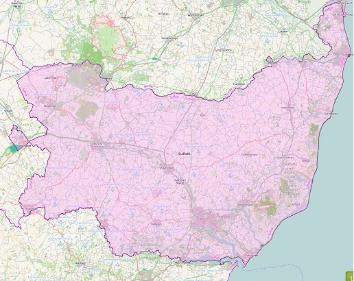

Suffolk County
(Historic)
Map Reference: (52.191839, 1.038308)
Suffolk is the easternmost county in Britain. Though generally low lying, it contains a rich variety of landscapes. Suffolk is famous for its exquisitely picturesque villages. Those in the Stour valley (“Constable Country”), including Cavendish, Clare, Lavenham and Long Melford, are characterised by thatch and brightly coloured plaster. The coast of Suffolk is smooth and sandy but prone to erosion. The town of Orford is separated from the coast by Orford Ness, a long, wide shingle spit at the mouth of the Ore, grown up over the centuries. Felixstowe is a substantial port at the south end of the coast, where the Orwell and Stour estuaries converge. Upriver on the Orwell is Ipswich, the county’s main town. The port and resort of Lowestoft lies at the north end of the coast. Lowestoft Ness is the easternmost point of Great Britain. North of Lowestoft lie the lakes and rivers of the Suffolk Broads, part of The Broads National Park. Elsewhere, the east of the county is largely rural with several small towns including Bungay, Beccles, Saxmundham and Woodbridge. The far north-west corner of Suffolk lies in the fenland. On the edge of the fens are the small towns of Mildenhall and Lakenheath, to the east of which lies the gorse-covered sandy heath of Breckland. The main town in the west is Bury St Edmunds, a small, pretty town around a large cathedral; St Edmundsbury Abbey. Furthest west is Newmarket, famous for and dominated by horseracing.