
Staffordshire County
(Historic)
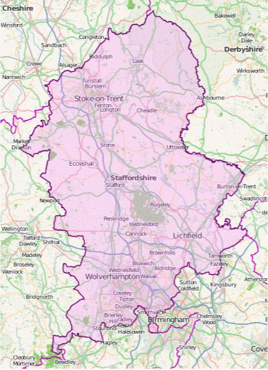
Map Reference: (52.799859, -2.057622)
Staffordshire is an inland county in the English Midlands. Staffordshire stretches from the Black Country in the south into forest in the north, and within these lands it bears all the contrast of industry and urban life, gentle farmland, modernity and history, and the beginnings of the fell country. Much of the south-west of Staffordshire lies in the Black Country, including Wolverhampton, West Bromwich, Walsall, Coseley, Tipton, Bilston, Darlaston and Wednesbury. Another hive of urban industry, where the Industrial Revolution began, is the Potteries, a district on the upper Trent where six industrial towns grew together to become Stoke on Trent. In complete contrast, elsewhere in the county there is fine natural scenery. Dovedale and Beresford Dale are renowned. The high ground north of Leek has beautiful valleys as the land rises up to the Peak District. In the centre of the county is Stafford itself. Lichfield has a large and ornate three-spired mediæval cathedral. Between the two, there remains something of the open heaths of Cannock Chase. Burton-on-Trent in the east is historically the heart of the brewing industry.