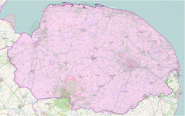
Norfolk County
(Historic)
Map Reference: (52.684192, 0.900106)
Norfolk is a large county in East Anglia. The county is famously flat and mainly rural. Visitors are charmed by cornfields patterned with cornflowers and poppies, and windmills. The north-western corner of Norfolk is on the Wash, where once was marshland running many miles inland, now drained, and the edge of the Great Fen. King's Lynn and Downham Market lies on the edge of the fenland. South of the fens lies Breckland, a country of open heathland and bracken. Elsewhere, western Norfolk is an agricultural area with the market towns of Swaffham, Watton and Fakenham. In the south-eastern part of Norfolk lie the Norfolk Broads, a network of navigable rivers and lakes formed by the flooding of peat workings. On the county's east coast lie the resorts of Great Yarmouth and Cromer. On the north coast, at Cley-next-the Sea and Blakeney, low tide reveals muddy marshes with long creeks, a haven for birdwatchers. Norwich, the county town, is famous for the number of its ancient parish churches. Amongst them the greatest church is the Cathedral, with one of the highest spires and one of the longest naves in the land, not overblown but all in perfect architectural harmony.