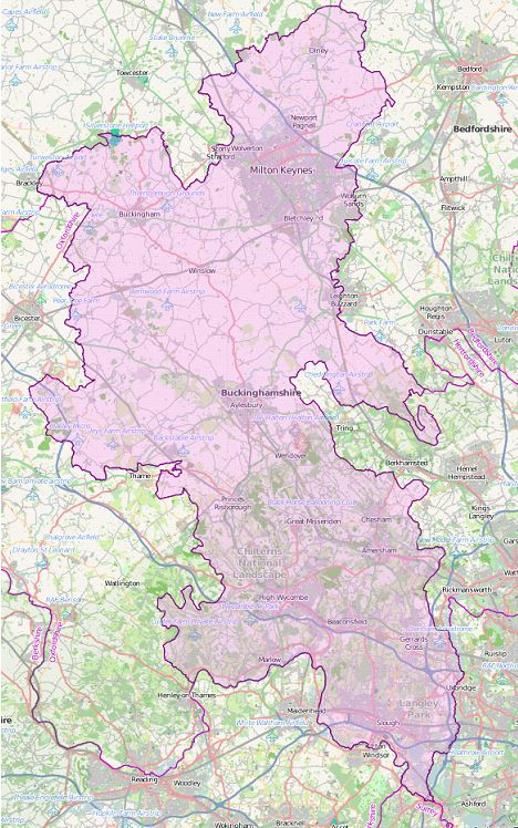

Buckinghamshire County
(Historic)
Map Reference: (51.843136, -0.836573)
Buckinghamshire is an inland county in the south of England. The Thames forms Buckinghamshire's southern border. On its banks are several pretty riverside villages, amongst them Datchet, Eton and Taplow. Slough and its suburbs form a major urban area in the south-east of the county. North of Slough lie Burnham Beeches, a 900-acre semi-ancient beech forest. Gerrards Cross and Beaconsfield lie north of the beeches. North of these, the delightful Chiltern Hills sweep north-westward across the county, with beech woods in the west, rising to higher, more windswept landscape around Ivinghoe Beacon, and all full of pretty villages of flint and thatch. The market towns of Amersham and High Wycombe lie amongst the Chiltern Hills. The Vale of Aylesbury is a large area of flat land in the midst of Buckinghamshire, drained by the River Thame and its tributaries. Aylesbury has been a major market town since Anglo-Saxon times. Buckingham is a bustling small market town. In the north-east of the county lies Milton Keynes, developed as a new town from the 1960s. Bletchley is known for Bletchley Park, the headquarters of Britain's Second World War codebreaking organisation. The market town of Olney, in the far north-east, is famous for the Olney Pancake Race which dates to 1455